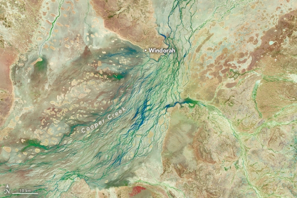
Heavy rainfall in Queensland sent floodwaters sweeping across vast stretches of the Australian outback in late March 2025. More than a year’s worth of rain fell in one week in some places. The deluge caused major flooding along multiple rivers in Channel Country, submerging small towns and grazing lands in southwestern Queensland.
While some portions of the flooded area remained obscured by clouds in late March, the OLI (Operational Land Imager) on Landsat 8 captured this mostly clear view of Cooper Creek near the town of Windorah on March 29 (right). For comparison, the left image, acquired by the OLI-2 on Landsat 9, shows the same area on March 5, before the intense rains. Both images are false color to emphasize the presence of water.
As waters rose, helicopter evacuations were organized for residents of Windorah and Jundah, a town about 75 kilometers (47 miles) upriver, according to news reports. Aerial photos showed settlements and pasturelands submerged, and government officials estimated that more than 100,000 livestock across Queensland may be missing or deceased.
Read more at: NASA Earth Observatory
Photo Credit: Michala Garrison, NASA Earth Observatory
Top Stories Sci/Tech Climate Ecosystems

