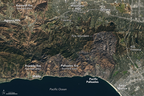
The Palisades fire ignited around 10:30 a.m. on January 7, 2025, near the Pacific Palisades neighborhood of Los Angeles, California. By midday the next day, the fire had grown to over 11,000 acres (44 square kilometers), and after one week, it had consumed nearly 24,000 acres (97 square kilometers) of wildland and developed areas.
The images above, acquired on January 14 by the OLI-2 (Operational Land Imager-2) on Landsat 9, show the area affected by the fire. In the natural color image (left), visibly charred areas stretch to the north and west of Pacific Palisades. Several lines of bright red or pink fire retardant dropped by aircraft appear along the perimeter of the burned area. (These are more visible in the larger image.)
The false-color image (right) combines shortwave infrared, near infrared, and visible components (OLI bands 6-5-3) of the electromagnetic spectrum. This band combination makes it easier to identify unburned vegetation (green) and recently burned landscape (light to dark brown).
Read more at NASA Earth Observatory
Image: NASA Earth Observatory images by Lauren Dauphin, using Landsat data from the U.S. Geological Survey.
Sci/Tech Top Stories
