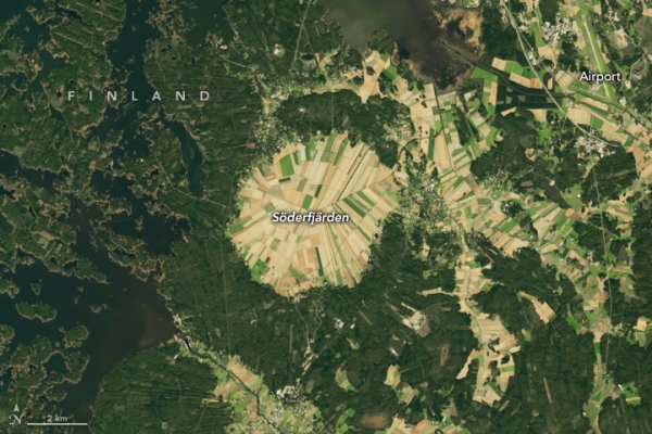
More than half a billion years ago, a meteorite struck Earth near the Antarctic Circle, leaving a divot several kilometers in diameter. In the hundreds of millions of years that followed, the movement of Earth’s tectonic plates brought that cratered piece of crust far into the Northern Hemisphere.
Today, the Söderfjärden impact crater occupies a 22 square-kilometer piece of coastal real estate in western Finland near the Gulf of Bothnia, the Baltic Sea’s northern arm. The OLI-2 (Operational Land Imager-2) on Landsat 9 acquired this image of the hexagonal-shaped crater in September 2024. The feature stretches more than 5.5 kilometers (3.4 miles) from east to west and is divided into many agricultural fields.
In its Scandinavian locale, however, Söderfjärden has not always been on dry land. During the Last Glacial Maximum, around 20,000 years ago, a thick, heavy sheet of ice covered the area and pressed the land down hundreds of meters. Now free of that weight, the land has been bouncing back with some of the highest rates of uplift, or glacial isostatic adjustment, on Earth. New ground emerges from the sea every year.
Photo Credit: NASA Earth Observatory, Wanmei Liang, using Landsat data from the U.S. Geological Survey
Sci/Tech Top Stories Climate

