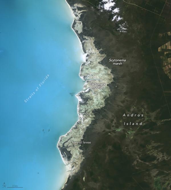
When University of Miami geologist Robert Ginsberg passed away in 2017, colleagues noticed something intriguing while sorting his papers: a collection of black-and-white aerial photographs of parts of the Bahamas. Closer inspection revealed they were British Royal Navy reconnaissance photos taken during World War II. Among them were images shot in 1943 of the coastline of Andros, the largest island in the Bahamas.
Comparing these vintage photographs with modern Landsat satellite images has provided scientists with insight into how sea level rise has transformed the island’s inland marshes over the past 80 years, even as the shoreline remained mostly unchanged.
Data collected by tide gauges indicate that sea level at Andros Island rose by roughly 10 centimeters (4 inches) between 1985 and 2018—at roughly the same rate that global sea level has increased since the 1990s. Research-grade tide gauge data is not available for Andros Island back to the 1940s, but experts calculate sea level in the region has increased by an average of 0.18 centimeters per year since 1950.
Read more at: NASA Earth Observatory
Antarctic blue whales are the world’s largest animal, and are still recovering from being hunted nearly to extinction during 20th century whaling. (Photo Credit: Paula Olson)
Sci/Tech Top Stories Climate

